Spatial Data

.jpg)

ST_GeomFromGeoJSON arriving to PostGIS
Discover the integration of GeoJSON on PostGIS, enabling better import methods and direct usage for CartoDB. Read about the development consultancy by OpenGeo.


Introducing CARTO Traffico: A Crowdsourced GPS Data Traffic Management Solution
CARTO Traffico is a traffic management solution for civic engineers and urban planners that integrates crowdsourced GPS data with city specific mobility data sources to help cities adapt to citizens’ changing transportation behavior


Partnering with Mapbox: A New Stack for Location Intelligence
Partnering with Mapbox: A New Stack for Location Intelligence

Vision Zero in the New Era of Location Data Streams
Bringing together different location data streams provides a modern alternative to traditional traffic impact studies. In this post we’ll present what value different types of location data add to mobility analysis.

The Quantified City: A Closer Look at Chicago's Array of Things
Discover how Chicago pioneers the quantified city with Array of Things. Harnessing IoT for smarter urban living. Learn more now!

CARTO brings geospatial data and analytics to Salesforce Einstein Analytics
We're partnering with Salesforce to deliver location intelligence capabilities directly into Salesforce Einstein Analytics.

Building A Real Estate Investment Strategy With Location Intelligence
From identifying new areas for potential investment to better understanding real estate investment risks, we look at some of the ways location data can support your investment strategy.

How Insurance Uses Location Data to Prepare for Natural Disasters
Embracing Location Intelligence can help insurers to reduce their exposure to risk, while preparing and offering policyholders better service and more varied plans that meet their needs.
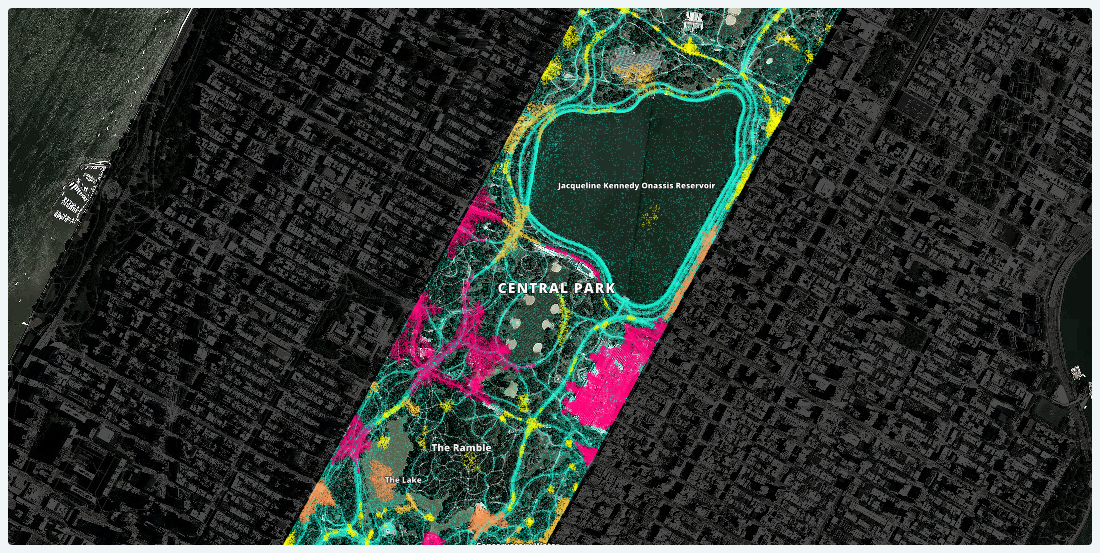
Lessons Learned from Analyzing Over a Million Points of GPS Data
Working with one month of nation-wide GPS data, A Million Walks in the Park explores the use of public spaces, specifically public parks across New York City, to understand social interactions among New Yorkers.

Global Partnership: Democratizing Data & Location Intelligence for Development
Democratizing Data & Location Intelligence: The Global Partnership for Sustainable Development Data is Working Towards the SDGs

4 Ways Data Enrichment Can Improve Your Raw Business Data
Implementing data-driven decision making can only show a return on investment for businesses if analysts ask the right questions with the right data. Here are the right questions to ask.

Academy

Google Cloud Next 2025: Key takeaways for geospatial
Discover key geospatial insights from Google Cloud Next 2025 - AI, low-code tools, Earth Engine, and more innovations shaping the future of location tech.
.jpg)
Telco dashboards: Turning accessible data into actionable insights
Discover how CARTO enhances data accessibility, empowering decision-makers with actionable insights to improve network access for senior citizens and communities.
The first 5 maps everyone needs to make with CARTO
New to CARTO? Start with these 5 essential maps! Learn how to analyze proximity, work with big data, integrate real-time updates, and leverage AI-driven insights.