.png)


The Changing Role of the GIS Analyst
Discover how GIS Analysts are evolving from map makers to strategic AI-driven experts shaping enterprise decision-making with cloud-native tools.


Introducing CARTO Workflows: Spatial analytics for all users
CARTO Workflows provides a complete user interface for spatial analysis that leverages the power of spatial SQL and cloud data warehouses.


What's New in CARTO - Q3 2022
Announcing our latest release of CARTO cloud-native features for Q3 2022.


IoT Analytics & Geospatial Data: How It Works
We explore how IoT Analytics use cases are driven by geospatial data for catastrophe modeling, in smart cities & supply chain.


Using trade area analysis for CPG merchant segmentation
See how CPG data teams use trade area analysis, consumer insights & spatial data to optimize point of sale networks

Data warehouses vs. GPU accelerated analytics for geospatial analysis
We explore the benefits of using data warehouses with spatial capabilities over GPU accelerated analytics for geospatial analysis.


Databricks support for H3 in collaboration with CARTO
Introducing H3 for Databricks with CARTO! Unlock fast and efficient big data analytics in the cloud with Spatial Indexes


CARTO Driving Sustainability Impact Worldwide on Google Cloud
CARTO and Google Cloud have collaborated on sustainability projects for micro-mobility, government infrastructure, and preserving natural resources use cases.


Spatial Data Scientist of the Year Award 2022
At #SDSC22 the first winner of the Spatial Data Scientist of the Year award will be announced. Submit your nomination today!

CARTO’s Ultimate Guide to Spatial Joins & Predicates with SQL
Get started with Spatial SQL with this guide to using spatial relationships.
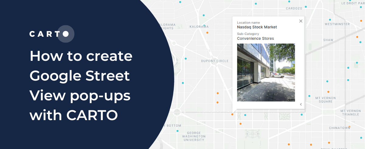
How to create Google Street View pop-ups with CARTO
CARTO's guide to using Google Street View images in your map pop-ups.

Using Location Intelligence to combat The Great Resignation in Logistics
The Great Resignation means competition for staff is ever increasing. CARTO explores how spatial unemployment patterns can be used to tackle this.

Venue Suitability Analysis for the Eurovision Song Contest with CARTO
How to use Location Intelligence to pick the optimal venue for the UK's Eurovision Song contest with CARTO

Academy
The Changing Role of the GIS Analyst
Discover how GIS Analysts are evolving from map makers to strategic AI-driven experts shaping enterprise decision-making with cloud-native tools.
Unlock planetary-scale insights with CARTO & Google Earth AI
Learn how CARTO & Google Earth AI make planetary-scale insights accessible with foundation models & Agentic GIS.

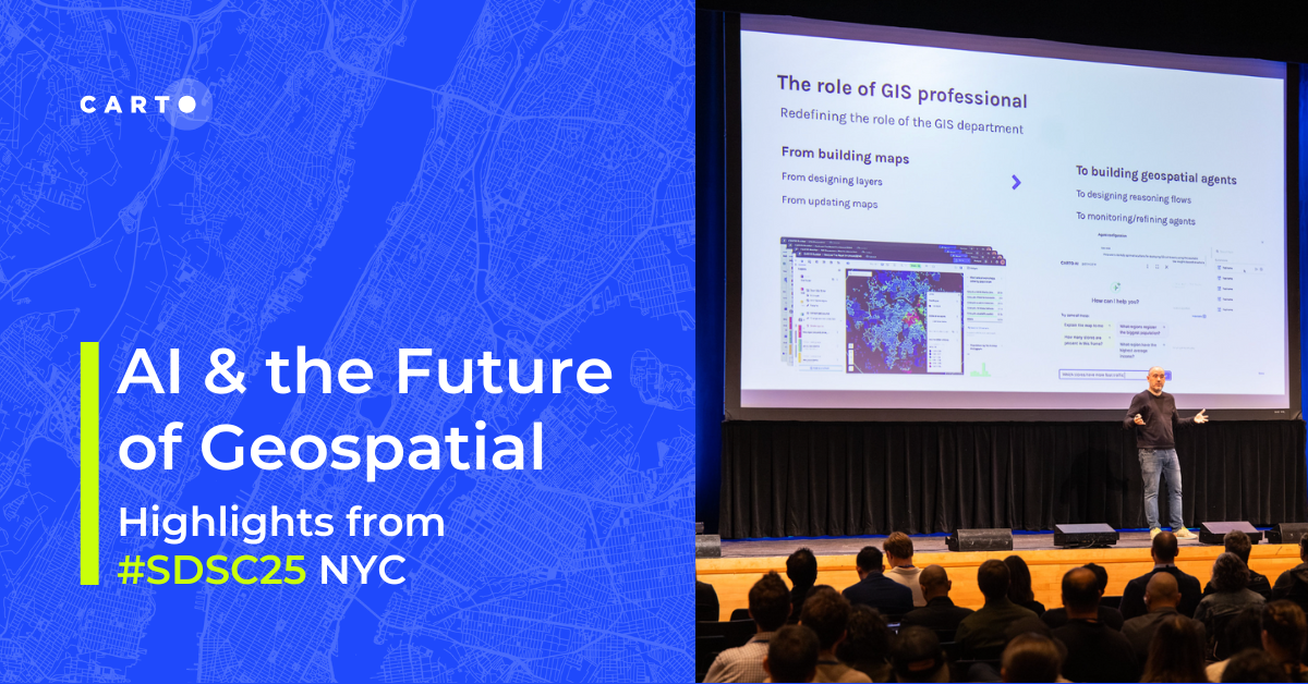
AI & the Future of Geospatial: Highlights from #SDSC25
AI and Agentic GIS are revolutionizing spatial analytics. Discover innovations, insights, and trends shaping the future from #SDSC25 New York.
.png)