

Use cases
.png)


Location Analytics: A Roadmap to Post COVID-19
Everyone has the same question: when will we return to normal? Spatial analysis has helped immensely to contain the spread, now how will it help us recover?


Analyzing Food Access in NYC During COVID-19
We explore how Territorial Empathy are using spatial analysis to visualize food access across NYC during the pandemic.

Mobilizing Volunteers to Help the Most Vulnerable through Maps
#StudentsAgainstCorona is a platform supported by our grants program enabling the pairing of volunteers with the elderly & vulnerable individuals who need support through the Coronavirus lockdown.
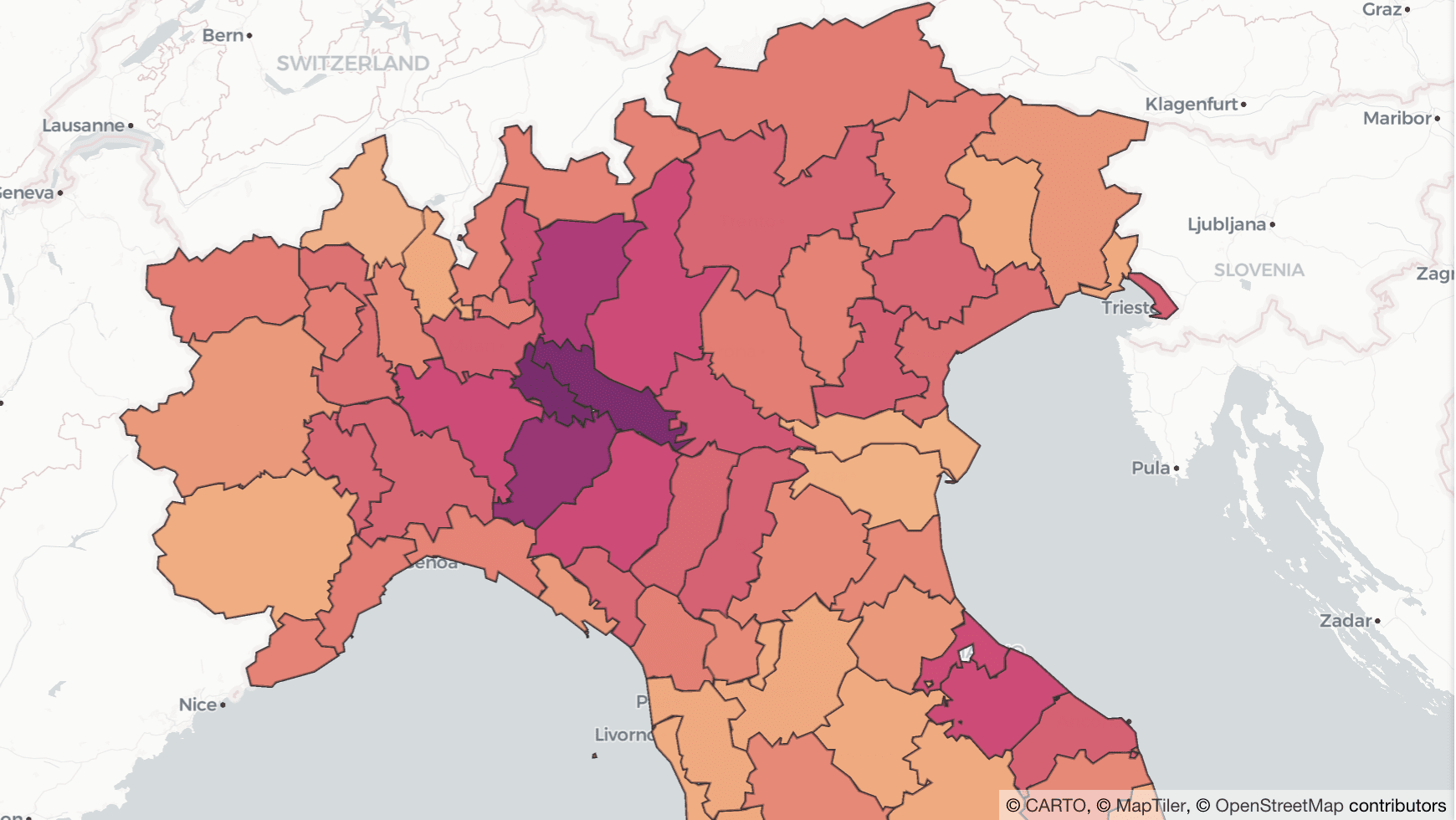

Why Lockdown Matters: Exploring Human Mobility Data in Italy
Analyzing the relationship between human mobility and the spread of COVID-19 in Italy.

US Social Determinants of Health Atlas - Map of the Month
Leveraging Spatial Analysis techniques, researchers from the University of Chicago and the AHA worked to define and visualize the social determinants of health in America.

Emerging Technology - Impacts on Location Intelligence
From Autonomous Vehicles, to Digital Twin, to Human Augmentation, new technology is set to change the world and the Location Intelligence industry is no different.

Map of the Month: Bringing Smallholder Coffee Farmers out of Poverty
Enveritas leverages Location Intelligence to visualize global coffee production and poverty levels among farmers, as they work towards a more sustainable global coffee industry


Site Planning for Market Coverage Optimization with Mobility Data
This case study shows how to use human mobility data to optimize market coverage in your site planning process for improved outcomes

Spatial Solutions for the SDGs - COP25
In anticipation of COP25, we wanted to explore some of the ways that spatial data analysis can help to achieve the SDGs and invite you to several events to discover it yourself!

Solving Global Litter with Machine Learning & Spatial Data
Learn how Litterati is leveraging Location Intelligence and Spatial Data Science in the fight against global litter


Academy


CARTO & Snowflake: Location Intelligence for Energy and Utilities
CARTO and Snowflake expanding cloud-native Location Intelligence for Energy and Utility organizations, unifying IoT data for resilient operations.

How to get your colleagues and clients excited about geospatial
A practical guide to building internal buy-in for geospatial, with tips on making the case to non-technical colleagues and leaders, speaking the right language.
Nagarro & CARTO: Advancing Enterprise AI Transformation
CARTO and Nagarro partner to help enterprises move AI from pilots to production, embedding Location Intelligence into existing workflows and systems.