


CARTO & Snowflake: Location Intelligence for Energy and Utilities
CARTO and Snowflake expanding cloud-native Location Intelligence for Energy and Utility organizations, unifying IoT data for resilient operations.


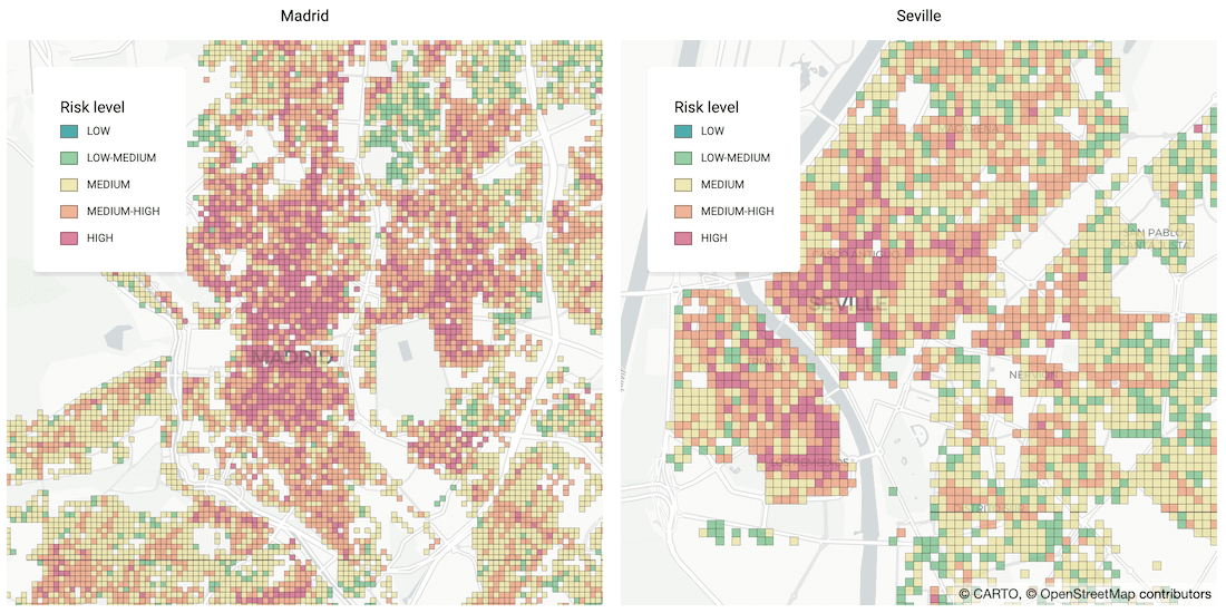


Identifying Areas Most Likely to Suffer Recession Post Pandemic
As many parts of the world enter into recession following the Coronavirus pandemic, read how Spatial Data Science can help identify areas with a greater risk


Human Mobility & Transport Analysis in the Canary Islands
Optimizing transport infrastructure spatially is key to the future of mobility - see how CARTO, Vodafone, & SAGULPA built a platform for the city of Las Palmas
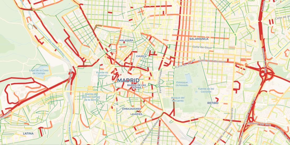

Visualize Waze Traffic Data using Google BigQuery & CARTO
Learn how to import Waze for Cities traffic big data into CARTO using our Google BigQuery Connector for easy analysis & visualization in our step by step guide


Our Thoughts as MapboxGL JS v2.0 Goes Proprietary
With Mapbox announcing a change in their licensing this week, we share our thoughts on this news, basemap neutrality, & the future of spatial app development

Announcing the CARTO Scientific Committee
We are very pleased to announce the formation of the CARTO Scientific Committee, and its inaugural members, to further advance the field of Spatial Data Science
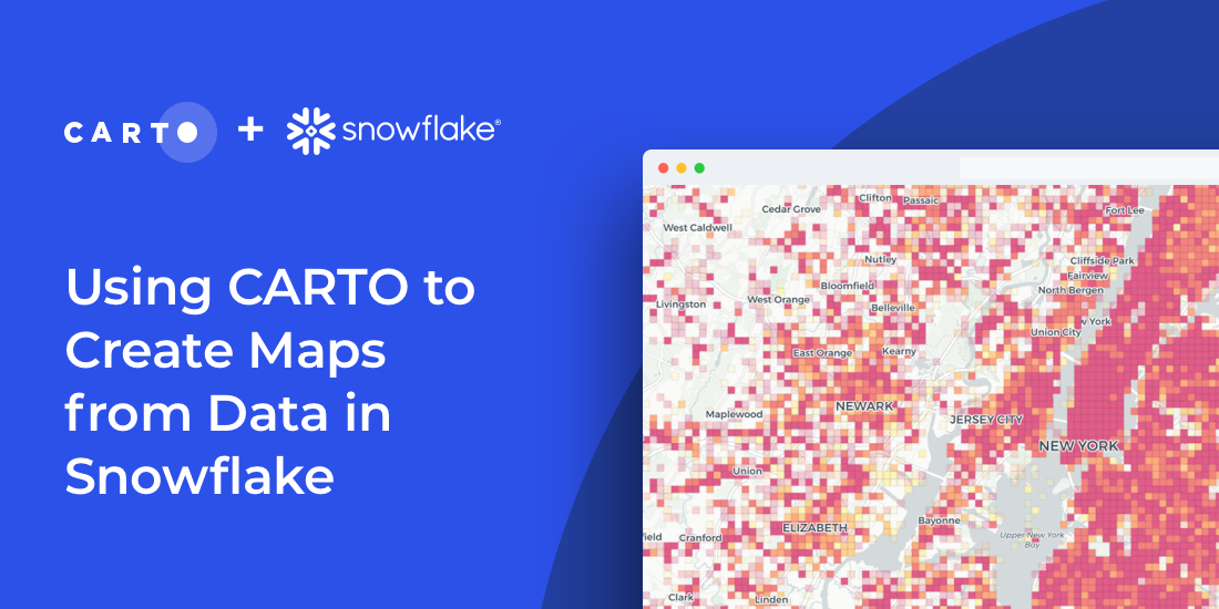

How to Create Maps from Snowflake using CARTO & SQL
Import millions of records from a Snowflake database using our new connector & create insightful visualizations. How to combine Snowflake data warehouse & CARTO

Analyzing UK Covid Recovery & Mobility with Avison Young
Explore Avison Young's UK Cities Recovery Index, monitoring commercial real estate rebound post-pandemic, analyzing diverse sectors, and predicting recovery trajectories.

Predicting Traffic Accident Hotspots with Spatial Data Science
Road traffic injuries are a leading cause of death & have a big economic effect. Read how Spatial Data Science can identify dynamic hotspots & reduce accidents.


Lifesight Human Mobility & Footfall Data now available in CARTO
We are pleased to announce our partnership with Lifesight, a leader in human mobility, & the inclusion of their data in our Data Observatory

COVID-19 Vaccine: Optimizing Cold Chain Transportation
With COVID-19 vaccines requiring strict storage, ensuring an efficient cold chain transportation network using spatial will be key for effective distribution


7 Reasons Why CPG Marketers Are Turning To Location Analytics
Discover how CPG/FMCG marketers & CMOs can use geospatial analysis & data to evolve their analytics to rapid consumer changes in the new normal

Short Term Rental Data from Transparent now available in CARTO
We are pleased to announce our partnership with Transparent, a leader in short-term rental intelligence, & the inclusion of their data in our Data Observatory

Academy

3 ways Location Intelligence is changing outdoor advertising
See how leading OOH companies use cloud-native spatial analytics and AI to move beyond impression counts and prove campaign ROI.
CARTO & Snowflake: Location Intelligence for Energy and Utilities
CARTO and Snowflake expanding cloud-native Location Intelligence for Energy and Utility organizations, unifying IoT data for resilient operations.

How to get your colleagues and clients excited about geospatial
A practical guide to building internal buy-in for geospatial, with tips on making the case to non-technical colleagues and leaders, speaking the right language.

