


Geospatial Foundation Models: Workshop Takeaways


.jpg)
Geospatial foundation models, often grouped under the broader umbrella of GeoAI, are emerging as one of the most promising directions in geospatial analytics. Over the past two years, interest has grown rapidly, driven by advances in large-scale representation learning and the release of models such as Clay and Google’s Population Dynamics Foundation Model (PDFM).
At the same time, many fundamental questions remain open: How to access and process data at scale? How to design robust architectures? How to evaluate models reliably? How to integrate them into real analytical workflows?
In short, moving from promising prototypes to operational systems remains a significant challenge.
This combination of momentum and uncertainty makes the field particularly compelling today. There is clear potential to rethink how we analyze places, movement, and human activity — but also a growing awareness that technical progress alone is not enough.
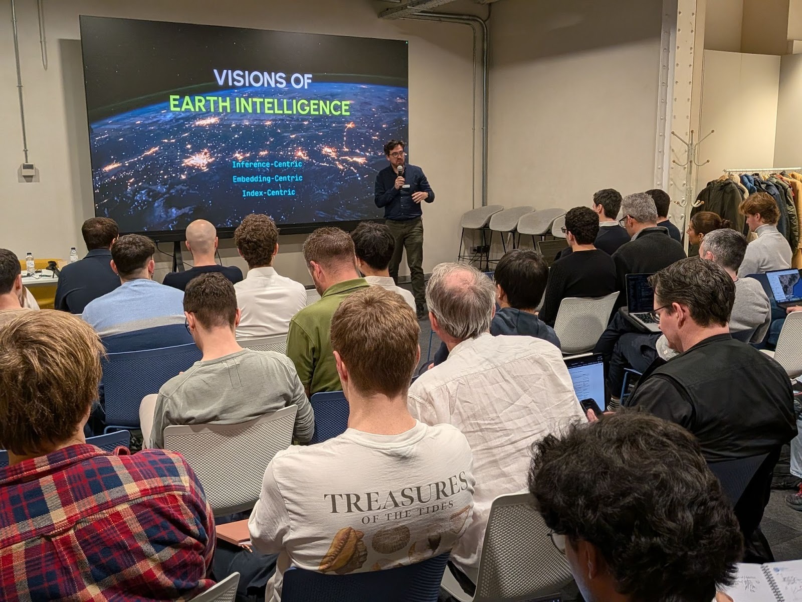
With this context in mind, CARTO and the Barcelona Supercomputing Center (BSC) organized the Geospatial Foundation Models Workshop in Barcelona last week, creating a space to reflect, exchange experiences, and connect research with practice.
To learn more, check out some of the workshop talks here.
The workshop brought together practitioners and researchers across industry, academia, and public institutions, including teams from Google Research, LGND AI, Northeastern University, and several professional and research groups working at the frontier of geospatial AI.
Across invited talks, lightning presentations, and open discussions, participants explored a wide range of topics:
- Large-scale representation learning
- Retrieval-based systems
- Population dynamics
- Infrastructure for training and evaluation
- The role of domain knowledge in model design
Rather than converging on a single methodology, the event highlighted the diversity of approaches currently being explored and the value of sharing both successes and limitations. In particular, discussions contrasted two broad families of models: those rooted in Earth observation data and those focused on population and behavioral dynamics.
One of the strongest messages throughout the day was that while the availability of geospatial foundation models is increasing rapidly, adoption in real-world applications is slow and largely experimental.
In an effort to overcome this gap between research and adoption, invited talks illustrated different angles.
Bruno Sanchez-Andrade (LGND AI) framed the discussion around different visions of “Earth intelligence”, contrasting inference-centric, embedding-centric, and retrieval-first perspectives. He argued that many geospatial systems remain “data-rich but information-poor,” and that scalable retrieval and indexing strategies may offer a more pragmatic path toward operational intelligence.
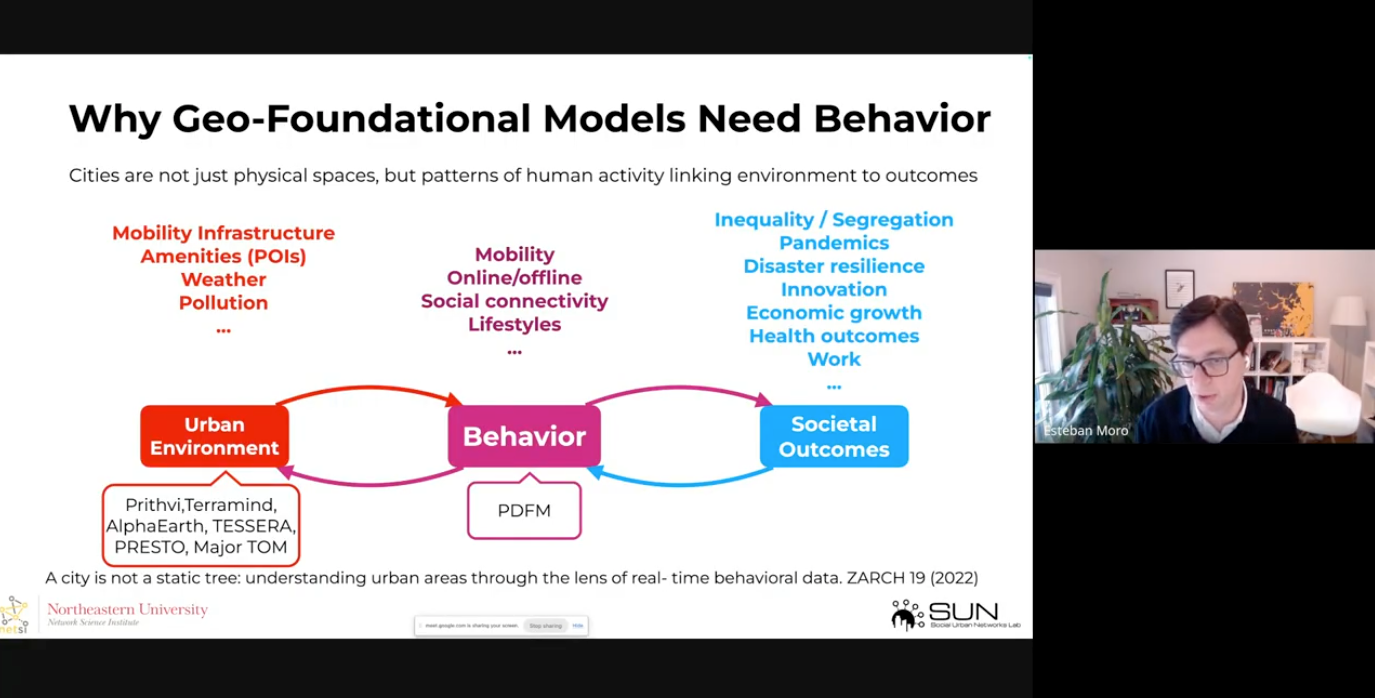
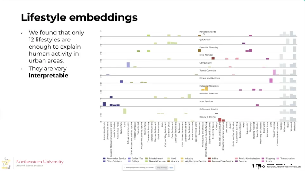
Esteban Moro (Northeastern University) focused on behavioral embeddings for urban analysis, introducing “lifestyle embeddings” as reusable representations of human activity. His work highlighted the importance of interpretability, stability, and fairness, especially when models are used to inform public policy and social interventions.
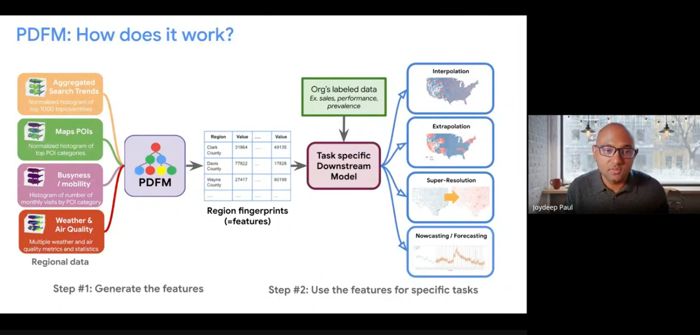
Joydeep Paul (Google Research) presented the Population Dynamics Foundation Model (PDFM), showing how large-scale behavioral embeddings can consistently improve prediction, super-resolution, and forecasting tasks across domains such as health, mobility, and socioeconomics. His talk demonstrated how foundation models can generate measurable value when they are carefully integrated into downstream workflows.
The lightning talks following the talks complemented these perspectives with a wide range of practical experiences and emerging ideas. Speakers shared work on:
- Multimodal embeddings
- Domain-specific fine-tuning
- Scalable training pipelines
- Applied use cases in areas such as environmental monitoring, infrastructure analysis, and mobility
Throughout the workshop, several presentations highlighted the gap between experimental results and production-ready systems, emphasizing the importance of data engineering, validation workflows, and close collaboration between researchers and practitioners.
Despite rapid progress, the workshop made clear that several obstacles still stand in the way of widespread adoption.
First, what Bruno (LDNG AI) described as different “versions of Earth Intelligence” (inference-centric, embedding-centric, and retrieval-first approaches), each with different strengths and limitations. Their coexistence reflects both the richness of the field and the absence of a clear, dominant paradigm driven by real-world use cases.
Second, architectural design remains particularly challenging for population dynamics and behavioral models, where interactions between people, places, and time introduce layers of complexity beyond pixel-based representations. Questions around multiresolution modeling, seasonal effects, and graph-based structures remain active research areas.
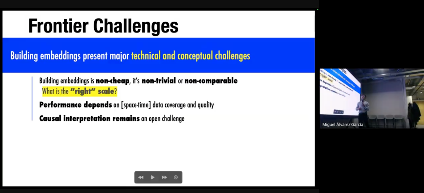
Third, interpretability and explainability continue to be major concerns. This lack of transparency can slow adoption, as decision-makers, especially in sensitive domains, require models whose outputs can be understood and justified.
Finally, model evaluation still lags behind development. The absence of widely accepted benchmarks makes it difficult to assess readiness for deployment or to compare approaches fairly.
Within this broader landscape, CARTO’s work focuses on making geospatial foundation models usable in practice.
Our approach combines three complementary efforts: integrating third-party embeddings into CARTO workflows, developing analytical tools that operate directly on embeddings, and building our own models for population dynamics.
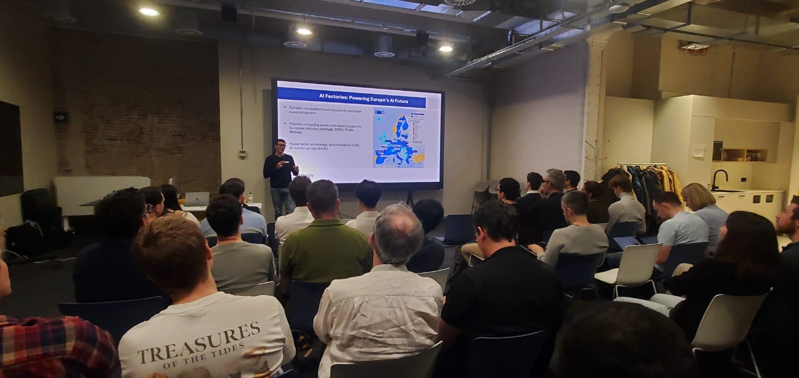
A key enabler of this work is our long-standing collaboration with the Barcelona Supercomputing Center. Through the European AI Factory program, we at CARTO are using high-performance computing infrastructure to train and evaluate models focused on population dynamics and human activity patterns.
The workshop confirmed that geospatial foundation models are moving from an exploratory phase toward more mature applications, but that sustained collaboration will be essential to get there. To learn more, check out some of the workshop talks here.
Many of the most valuable moments came from informal exchanges, shared failure cases, and open questions. These conversations are just as important as technical breakthroughs.
We look forward to continuing this dialogue on the state of Geospatial Foundation Models with the community and encourage joining us at the next Spatial Data Science Conference in London on May 14th.This upcoming event is another great opportunity to bring together researchers, practitioners, and decision-makers working across spatial analytics and AI.
Thank you to all speakers and participants for making the workshop such a stimulating and constructive event. We are excited to build on the ideas that emerged in Barcelona.


.png)
