

Spatial Data Science
.jpg)

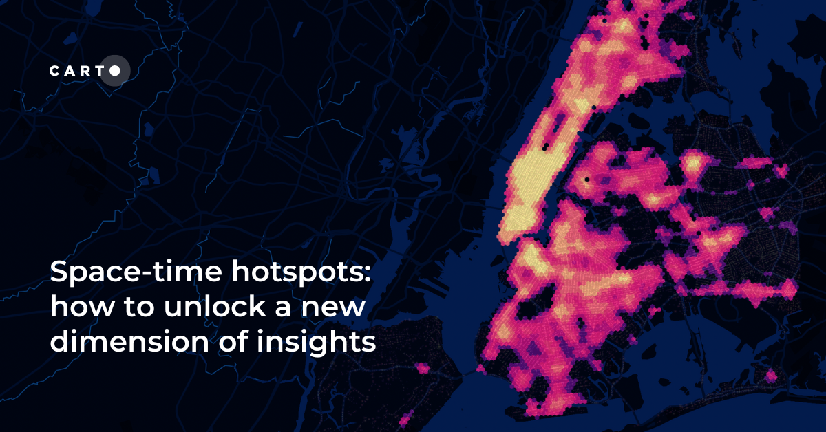


Space-time hotspots: how to unlock a new dimension of insights
How to use Space-Time Clustering to generate insights & optimize decision making with this step-by-step guide.


Spatial Scoring: Measuring Merchant Attractiveness & Performance
Learn how to use Spatial Scoring for Merchant Prioritization in the CPG Industry. Optimize sales and reduce costs with this step-by-step guide.

Cannibalization Analysis: what is it & how can I use it?
Balance competing demands between multiple business locations with our 4-step guide to Cannibalization Analysis: from data collection to decision!


Boosting Retail & CPG Sales with Sentiment Analysis
Leverage sentiment analysis for retail growth. Explore Data Appeal's insights, using sentiment data for strategic business expansion. Free 14-day trial.

Spatial interpolation: which technique is best & how to run it
Fix missing or coarse data with Spatial Interpolation. Compare IDW and Kriging methods & follow along with tutorials!
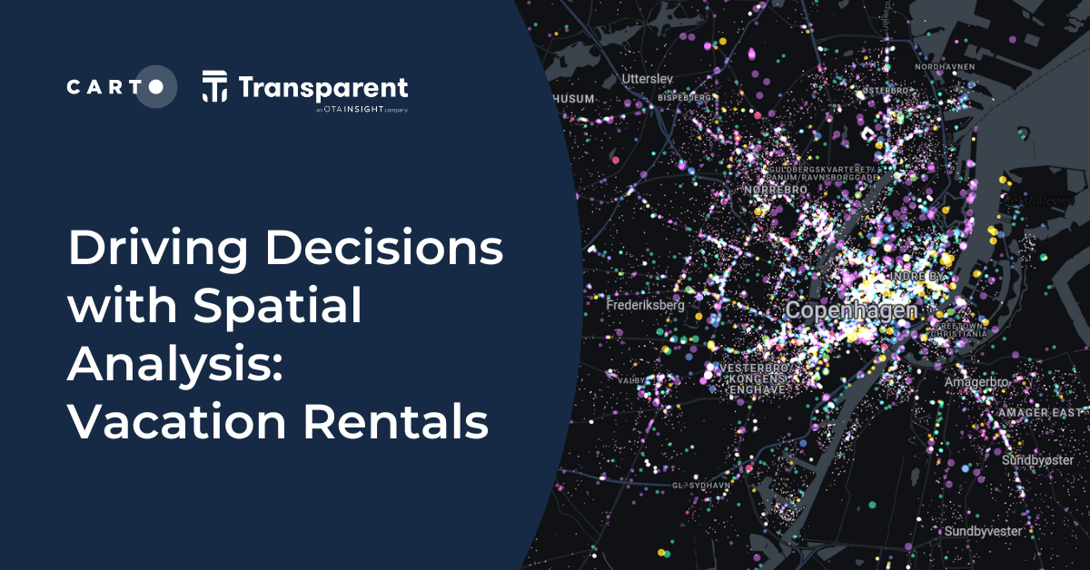

Driving Decisions with Spatial Analysis: Vacation Rentals
Discover spatial trends in vacation rentals & relationships with land use, ft. tutorials on how to conduct this analysis and use it to drive decision-making.

Do you need to code for a career in data?
Exploring the role of coding in data careers | Do you need to learn, and which language is right for you? Low-code, SQL, Python, R, HTML & Javascript.


Using Spatial Composites for Climate Change Impact Assessment
Learn how to assess climate change risks with spatial composites; measure impacts and support decision-making for infrastructure & natural resources.
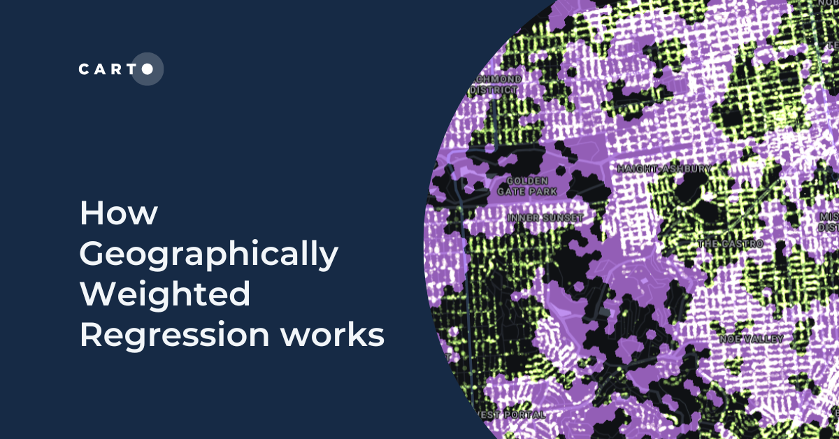
How Geographically Weighted Regression works
Find out what Geographically Weighted Regression (GWR) is, how it works, when to use it & how to use spatial indexes in conjunction.
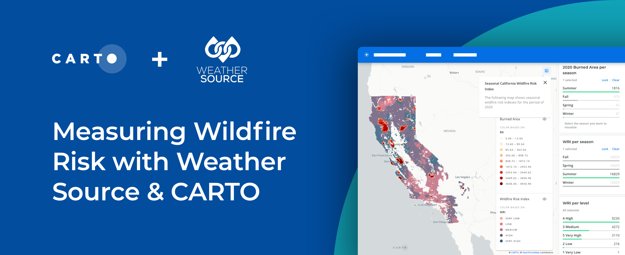
How to Use Spatial Data to Create a Wildfire Risk Map
Mitigate wildfire risks with our guide on creating a Wildfire Risk Map. Explore spatial analysis using Weather Source & CARTO for informed decision-making.

Understanding Retail Store Clusters with Local Outlier Factor Analysis
“See how Local Outlier Factor can be used as a tool for understanding the spatial patterns of retail store locations."


Site Selection for Retailers Using Commercial Hotspot Analysis
Explore an alternative analytical approach to tackle site selection decision-making based on advanced statistical techniques for retailers.

Academy


CARTO & Snowflake: Location Intelligence for Energy and Utilities
CARTO and Snowflake expanding cloud-native Location Intelligence for Energy and Utility organizations, unifying IoT data for resilient operations.
How to get your colleagues and clients excited about geospatial
A practical guide to building internal buy-in for geospatial, with tips on making the case to non-technical colleagues and leaders, speaking the right language.
Nagarro & CARTO: Advancing Enterprise AI Transformation
CARTO and Nagarro partner to help enterprises move AI from pilots to production, embedding Location Intelligence into existing workflows and systems.