

Use cases
.png)


Hurricane Season 2016: Locating Resiliency in Sandy's Aftermath
CARTO aids NYC's Mayor's Office in tackling climate change, visualizing risks, and preventing disasters like Hurricane Sandy. Explore OneNYC's efforts.


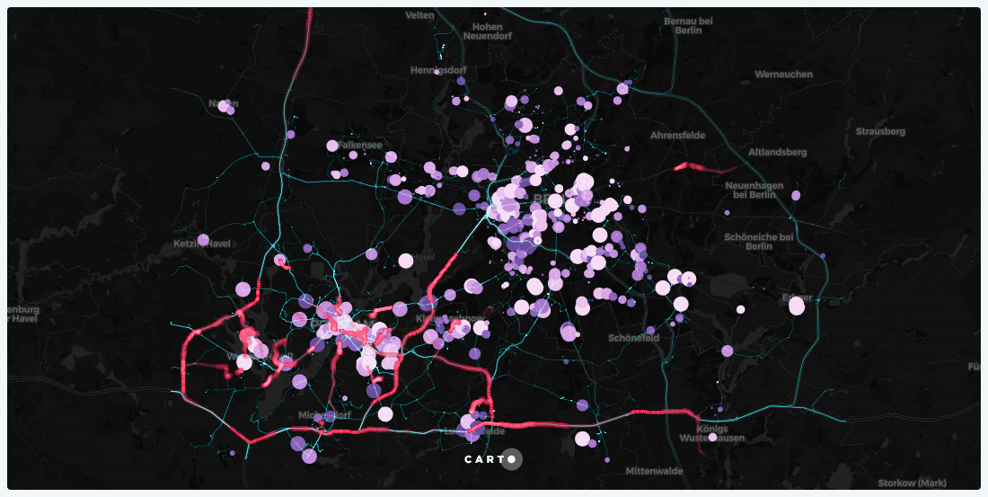
Map of the Month: Displacement Alert Map 2.0
Created using CARTO.js and pulling in open data from multiple sources, DAP Map will help in the fight against housing displacement.
Location Intelligence: The End of GIS As We Know It
GIS set the foundation for businesses to begin collecting and visualizing geographic information. But in order to stay competitive, businesses know they need to focus on the intelligence from their location data, not just on the geographic information itself.

Could these location-based bus improvements fix NYC transit woes?
As the subway enters a declared state of emergency, a new coalition is proposing changes based to the NYC bus system based on location data to help solve the city's transit woes.

Consulting Presentation Examples that Go Beyond PDF and PPT
Learn to deliver consulting presentations in a more engaging format using Location Intelligence tools.

Changing Neighborhoods: The case of New York City
Citizen-led organizations use geospatial tech and location intelligence to analyze housing markets and demographic changes. Learn about NYC, SF, and Chicago.

3 Businesses See More Green After Going Green
Location intelligence is the key to seeing green this Earth Day. Find out how your business can get green and see more of it too.


Academy


CARTO & Snowflake: Location Intelligence for Energy and Utilities
CARTO and Snowflake expanding cloud-native Location Intelligence for Energy and Utility organizations, unifying IoT data for resilient operations.

How to get your colleagues and clients excited about geospatial
A practical guide to building internal buy-in for geospatial, with tips on making the case to non-technical colleagues and leaders, speaking the right language.
Nagarro & CARTO: Advancing Enterprise AI Transformation
CARTO and Nagarro partner to help enterprises move AI from pilots to production, embedding Location Intelligence into existing workflows and systems.