


CARTO & Snowflake: Location Intelligence for Energy and Utilities
CARTO and Snowflake expanding cloud-native Location Intelligence for Energy and Utility organizations, unifying IoT data for resilient operations.


COPY'ing with the Python SDK
We'd like to introduce the COPY in the CARTO's Python SDK to you

4 Ways Data Enrichment Can Improve Your Raw Business Data
Implementing data-driven decision making can only show a return on investment for businesses if analysts ask the right questions with the right data. Here are the right questions to ask.

What We Learned About Open-Source Geospatial Technology at FOSS4G
If you missed this year’s FOSS4G conference, then catch up in our latest post with highlights from our team.


Mapping the Impact of Madrid's Line 5 Shutdown
Find out how Location Intelligence help local officials measure impact transit closures will have upon cities in our latest post.

Patching Plain PostgreSQL for Parallel PostGIS Plans
Stock PostgreSQL 10 can be improved for better PostGIS parallelism with a couple patches.
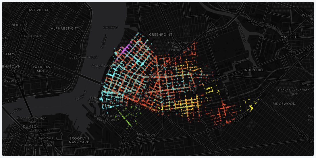
Using Location Data to Identify Communities in Williamsburg, NY
We wanted to explore how we can use data to better understand and define communities of people, going beyond spatial borders like zip code and neighborhood boundaries.

CARTO 2018: Our Year In Review
From start of year roadmaps to end of year industry recognition, here’s a brief recap of our very busy 2018!

How our solutions team engineered WaterHack 2018
Read about our first ever social and environmental datathon commemorating World Water Day and Earth Day and check out some results from WaterHack 2018

80 Data Visualization Examples Using Location Data and Maps
We've scoured the web in search of data visualizations showing the value of location data in its many varieties, and have compiled this list to bring you the very best examples.

Data Through Design Opening Reception: Kicking-Off NYC Open Data Week 2018 in Style
Data Through Design features works from developers, designers, and data professionals within the greater civic tech community that uses open data to better understand living in New York City.


Academy

3 ways Location Intelligence is changing outdoor advertising
See how leading OOH companies use cloud-native spatial analytics and AI to move beyond impression counts and prove campaign ROI.
CARTO & Snowflake: Location Intelligence for Energy and Utilities
CARTO and Snowflake expanding cloud-native Location Intelligence for Energy and Utility organizations, unifying IoT data for resilient operations.

How to get your colleagues and clients excited about geospatial
A practical guide to building internal buy-in for geospatial, with tips on making the case to non-technical colleagues and leaders, speaking the right language.

