

.jpg)


What’s new in CARTO - Q4 2025
Discover what’s new in CARTO Q4 2025, including Agentic GIS, AI-powered spatial analysis, MCP tools, analytics on embeddings, and enterprise governance updates.


Real Estate Market Analysis: Top 5 Data Streams
Real Estate Market Analysis needs to be data-driven, and given the spatial nature of Real Estate investment, you want the data that you are leaning on to be spatial data

Data Visualization: The Spread of Coronavirus
Visualizing data in emergency situations, like the spread of coronavirus, can provide decision makers with the insight needed to inform rapid response plans.

Enrich Spatial Analysis with Landgrid's Nationwide Parcel Data
Landgrid brings their nationwide parcel data, which Boasts over 143 million land parcels across 2,800 counties, to the CARTO Data Observatory
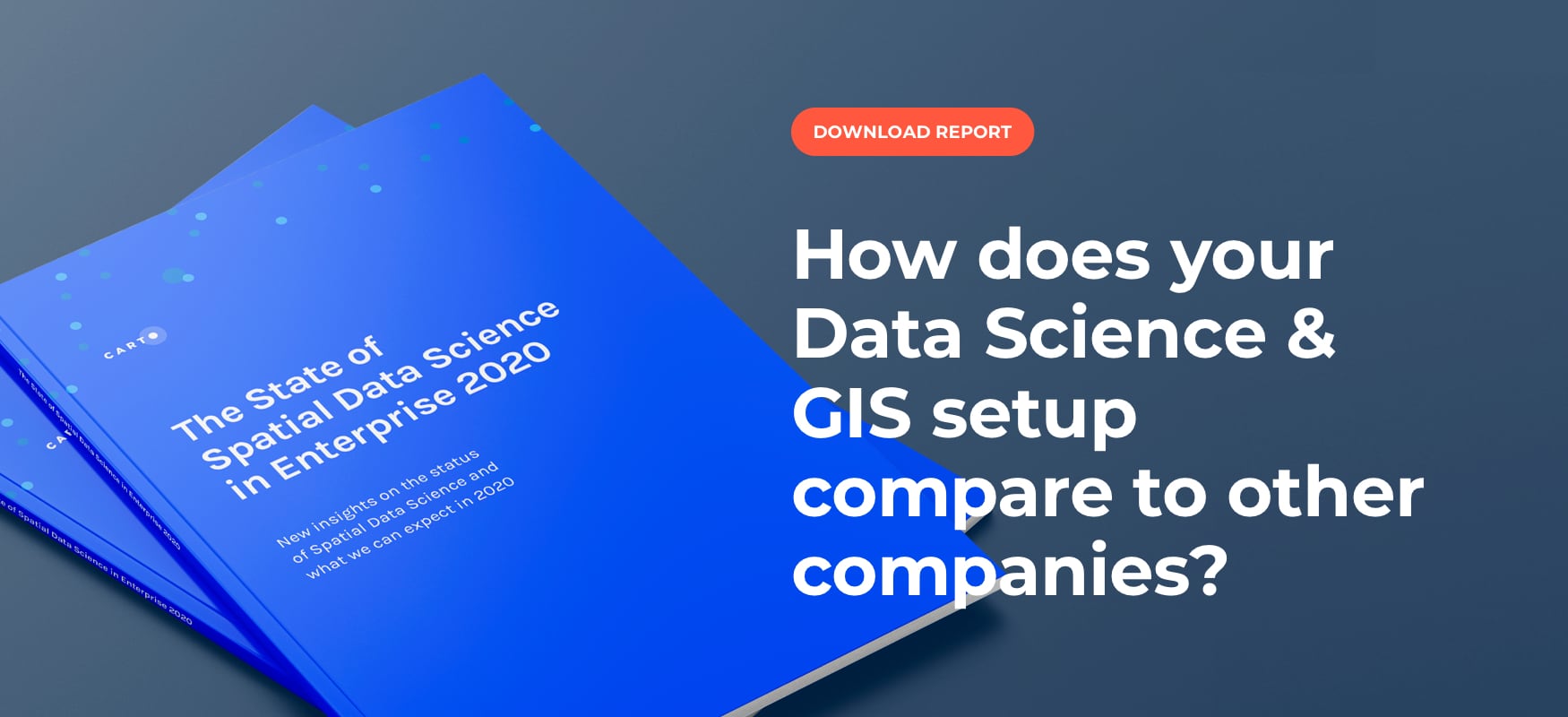
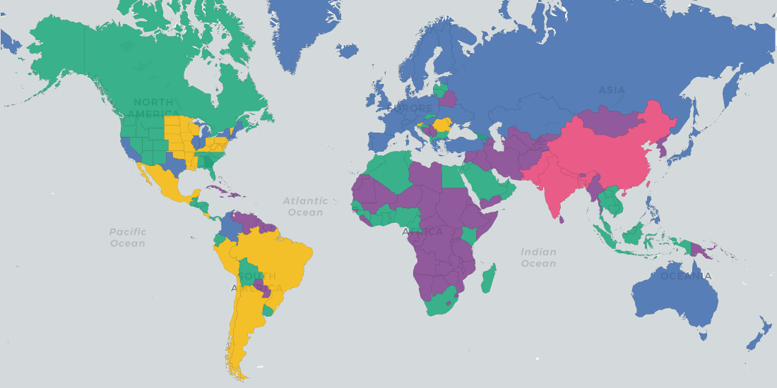
Top 3 Insights from The State of Spatial Data Science 2020
Discover key insights from our survey of how enterprise leaders from industries like Real Estate, Financial Services, Advertising and more are engaging with Spatial Data Science in 2020

Tackling Customer Churn for Utilities with Spatial Modeling
Spatial Data Science modeling can help Utilities companies to dramatically reduce customer churn and save millions in recurring revenue.

Speed up your spatial analysis with CARTOframes 1.0
CARTOframes is the go-to tool for powering analysis with spatial insights and efficiently working with spatial data and spatial models

Emerging Technology - Impacts on Location Intelligence
From Autonomous Vehicles, to Digital Twin, to Human Augmentation, new technology is set to change the world and the Location Intelligence industry is no different.

Top Location Intelligence and Spatial Stories
Celebrating the top stories, tips and tricks, tech updates, and of course, cool maps from around the worlds of Location Intelligence and Spatial Data Science
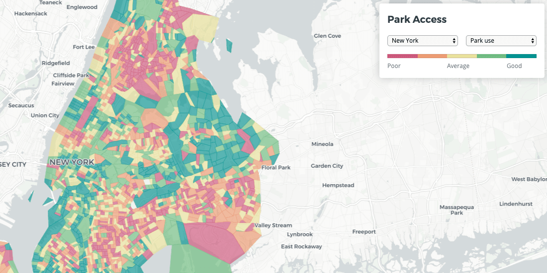
Quantifying Park Use in American Cities: Spatial Models and Novel Measures
Learn how cities can use spatial modeling to more accurately assess park use to inform planning and facilities decisions


Magnify your Analysis: Statistical Downscaling to Enhance Spatial Resolution
From understanding the dynamics of a business, to modelling physical and biological processes, selecting the proper spatial scale matters.


Spanish Residential Real Estate data in CARTO with Tinsa Digital
With new technology solutions and modern, verified data, real estate analysis no longer needs to be carried out in manual and rudimentary ways


Map of the Month: Bringing Smallholder Coffee Farmers out of Poverty
Enveritas leverages Location Intelligence to visualize global coffee production and poverty levels among farmers, as they work towards a more sustainable global coffee industry

Academy
What’s new in CARTO - Q4 2025
Discover what’s new in CARTO Q4 2025, including Agentic GIS, AI-powered spatial analysis, MCP tools, analytics on embeddings, and enterprise governance updates.

Turning Geospatial Foundation Models into Decisions using CARTO Workflows
CARTO now lets you run analytics directly on geospatial foundation model embeddings. Visualize, cluster, and detect changes to turn spatial data into decisions.

The State of Spatial Analytics 2026 - Register interest!
Key findings from the survey reveal major changes since 2024. Register interest now and get early access to the State of Spatial Analytics 2026 Report.

