


What is Agentic GIS?
Discover Agentic GIS: AI-powered spatial analysis that automates workflows, amplifies GIS expertise, and delivers actionable geospatial insights.

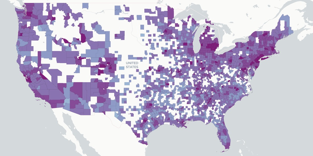

How Socioeconomic Factors relate to Mobility during COVID-19
A detailed geospatial analysis of how changes & regional disparity in human mobility during the COVID-19 lockdown can be related to socioeconomic indicators.


Announcing CARTO & Thinking Machines partnership
We are excited to announce that Thinking Machines a Data Science consulting firm specializing in geospatial, are now CARTO partners.


Using Location Intelligence to Combat Litter with PMI
In partnership with Philip Morris International, Litterati, & Cortexia, read how Spatial Data is being used to combat litter beginning with Lisbon, Portugal.

Map of the Month: Coffee Supply Chain Traceability
For our Map of the Month read how Enveritas use CARTO to analyze the traceability & sustainability of coffee supply chains around the world.


ATTOM in CARTO: School District Boundary Maps
School District Boundary Data from ATTOM Data Solutions is now available within our Data Observatory for use in your models & spatial analyses

Fintech Spatial Data Science Masterclass with J.P.Morgan
Read a summary of the DeepFin (where Fintech meets Deeptech) Investor Masterclass we recently held with J.P.Morgan, a leading global financial services firm.
Raster vs Vector Maps: What's the Difference & Which are Best?
A look at the key differences of raster vs vector maps for geospatial data visualization, advantages & disadvantages of each, & which are the best.

CARTO BigQuery Tiler is Now Available for Google Cloud Platform
Discover CARTO BigQuery Tiler, the only solution to visualize large location datasets straight out of Google BigQuery. Start creating stunning maps in minutes.

Where Do Expats Invest in Property on the Spanish Coast?
See how idealista used geospatial analysis & real estate location data to uncover fascinating insights on coastal property demand in Spain

CARTO & Google Cloud Announce Partnership
CARTO is now a Google Cloud Partner & available on the Google Cloud Platform Marketplace enabling analysis & visualization within a rich ecosystem.

Using Location Intelligence to return to Valencian beaches
Play&go with the collaboration of dotGIS develops an app using CARTO's platform to ensure health & safety on the beaches of Valencia, Spain.

Building COVID-19 Dashboards with Google BigQuery
See how private & public sector organizations use Google Cloud Platform with CARTO to share insights & map visualizations relating to the coronavirus pandemic.

Academy
What is Agentic GIS?
Discover Agentic GIS: AI-powered spatial analysis that automates workflows, amplifies GIS expertise, and delivers actionable geospatial insights.
Geospatial Sovereignty in the Age of AI: A Layered Approach
Geospatial sovereignty in the AI era: why open formats, flexible compute, and interoperable standards are key to resilient, independent digital infrastructure.

The Changing Role of the GIS Analyst
Discover how GIS Analysts are evolving from map makers to strategic AI-driven experts shaping enterprise decision-making with cloud-native tools.
.png)
.png)